#Gettysburg - 150 years
View of the Capitol under construction #onthisday 1863, photo taken 3 days before battle at #Gettysburg. pic.twitter.com/a0D3tSN6b7
— U.S. Capitol (@uscapitol) June 28, 2013
The History Channel has put together a collection of videos on the battle of Gettysburg. http://t.co/fwCYuaf2R1
— Gettysburg Festival (@gettysburgfest) June 28, 2013
150th Anniversary of the Battle of Gettysburg #gburg150 commemoration this weekend. http://t.co/WzKIRBpfnE
— National Cemeteries (@VANatCemeteries) June 28, 2013
GettysburgAddr: Welcome to Lincolns Gettysburg Address, presented here as a series of tweets #Abraham #Lincoln #Gettysburg #Address #Speech
— ReadByTweet_GA (@ReadByTweet_GA) June 29, 2013
Map could explain Lee’s decisions at #Gettysburg http://t.co/AcUI1paTfu http://t.co/oo9zqI97aY
— cccarto (@carto_mapper) June 29, 2013
150th anniversary of #Battle of #Gettysburg provides a bigger story http://t.co/MrPn03yTgK http://t.co/oo9zqI97aY
— cccarto (@carto_mapper) June 29, 2013
Are you going to #Gettysburg this weekend? If so, share your pics with us by using the #Gettysburg150 tag: http://t.co/ZPJTkEWR7R
— PennLive.com (@pennlive) June 28, 2013
With Hooker out, Meade has taken command -- the latest from our #Gettysburg "live" blog: http://t.co/0BE9lajvO4
— Military Times (@MilitaryTimes) June 27, 2013
#gettysburg pic.twitter.com/9qZsY6Uzqe
— Stephen Lang (@IAmStephenLang) June 28, 2013
This reenactment thing is something else #gettysburg150 #cw150 http://t.co/AADQA2fCGE @Storify
— Mila Sanina (@pgMila) June 29, 2013
AP Photographer Matt Rourke is at the re-enactment at #Gettysburg150. His images are like traveling in time. http://t.co/98bWpCrUZc
— Matt Moore (@MattMooreAP) June 28, 2013


 “My book is a human story, a search for my roots”. So says author Carol Walls Howell about her debut novel, Sunset in Kentucky.
Book Description
Publication Date: July 10, 2012
It is 1835 in Richmond, Kentucky, when a horse and buggy races down the road toward the home of Big Al and Lucy Bennings. Shortly after the buggy's arrival, a baby boy is born to a young farm couple, Brady and Anna Marie Patterson. As the Pattersons welcome little Patrick into their family, they embrace a new beginning fueled by hope. It is not long before Brady is recruited to accompany a search party intent on traveling up the Kentucky River to search for new fertile farmland to homestead. Anna Marie, now pregnant with their second child, begs Brady not to leave, but despite her misgivings, he succumbs to the temptation of what he thinks will be a great adventure. As the scouts encounter one unforeseen event after another, Anna Marie faces her own trials and tribulations in Brady's absence. But it is only after she receives word that Brady has been injured that she realizes she is plagued with loneliness and makes a decision that changes everything. In this historical tale filled with love, camaraderie, and adventure, a woman grows to become a strong pioneer and mother as her husband discovers his journey to a better life is more challenging than he ever realized.
About the Author
Carol Walls Howell was a music teacher and librarian for twenty-two years. Now retired, she lives with her husband, Carl, on a small farm in Macon, Missouri, where she enjoys researching her genealogy, gardening, sewing and traveling with her husband.
Sunset in Kentucky [Hardcover]
“My book is a human story, a search for my roots”. So says author Carol Walls Howell about her debut novel, Sunset in Kentucky.
Book Description
Publication Date: July 10, 2012
It is 1835 in Richmond, Kentucky, when a horse and buggy races down the road toward the home of Big Al and Lucy Bennings. Shortly after the buggy's arrival, a baby boy is born to a young farm couple, Brady and Anna Marie Patterson. As the Pattersons welcome little Patrick into their family, they embrace a new beginning fueled by hope. It is not long before Brady is recruited to accompany a search party intent on traveling up the Kentucky River to search for new fertile farmland to homestead. Anna Marie, now pregnant with their second child, begs Brady not to leave, but despite her misgivings, he succumbs to the temptation of what he thinks will be a great adventure. As the scouts encounter one unforeseen event after another, Anna Marie faces her own trials and tribulations in Brady's absence. But it is only after she receives word that Brady has been injured that she realizes she is plagued with loneliness and makes a decision that changes everything. In this historical tale filled with love, camaraderie, and adventure, a woman grows to become a strong pioneer and mother as her husband discovers his journey to a better life is more challenging than he ever realized.
About the Author
Carol Walls Howell was a music teacher and librarian for twenty-two years. Now retired, she lives with her husband, Carl, on a small farm in Macon, Missouri, where she enjoys researching her genealogy, gardening, sewing and traveling with her husband.
Sunset in Kentucky [Hardcover]

 " Among the darkest corners of Kentucky's past are the grisly feuds that tore apart the hills of Eastern Kentucky from the late nineteenth century until well into the twentieth. Now, from the tangled threads of conflicting testimony, John Ed Pearce, Kentucky's best known journalist, weaves engrossing accounts of six of the most notorior accounts to uncover what really happened and why. His story of those days of darkness brings to light new evidence, questions commonly held beliefs about the feuds, and us and long-running feuds -- those in Breathitt, Clay Harlan, Perry, Pike, and Rowan counties. What caused the feuds that left Kentucky with its lingering reputation for violence? Who were the feudists, and what forces -- social, political, financial -- hurled them at each other? Did Big Jim Howard really kill Governor William Goebel? Did Joe Eversole die trying to protect small mountain landowners from ruthless Eastern mineral exploiters? Did the Hatfield-McCoy fight start over a hog? For years, Pearce has interviewed descendants of feuding families and examined skimpy court records and often fictional newspapeputs to rest some of the more popular legends.
Days of Darkness: The Feuds of Eastern Kentucky [Paperback]
Days of Darkness: The Feuds of Eastern Kentucky [Kindle Edition]
" Among the darkest corners of Kentucky's past are the grisly feuds that tore apart the hills of Eastern Kentucky from the late nineteenth century until well into the twentieth. Now, from the tangled threads of conflicting testimony, John Ed Pearce, Kentucky's best known journalist, weaves engrossing accounts of six of the most notorior accounts to uncover what really happened and why. His story of those days of darkness brings to light new evidence, questions commonly held beliefs about the feuds, and us and long-running feuds -- those in Breathitt, Clay Harlan, Perry, Pike, and Rowan counties. What caused the feuds that left Kentucky with its lingering reputation for violence? Who were the feudists, and what forces -- social, political, financial -- hurled them at each other? Did Big Jim Howard really kill Governor William Goebel? Did Joe Eversole die trying to protect small mountain landowners from ruthless Eastern mineral exploiters? Did the Hatfield-McCoy fight start over a hog? For years, Pearce has interviewed descendants of feuding families and examined skimpy court records and often fictional newspapeputs to rest some of the more popular legends.
Days of Darkness: The Feuds of Eastern Kentucky [Paperback]
Days of Darkness: The Feuds of Eastern Kentucky [Kindle Edition]


.jpg)


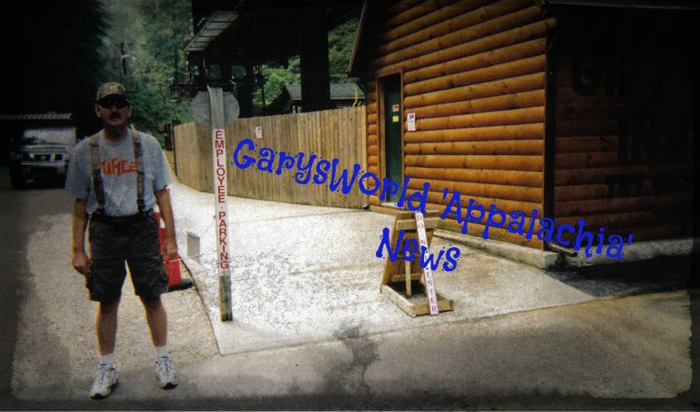

 West Liberty (Before) the tornado on March 2, 2012...A small,pretty quaint town!!